Home > Travel > Ísland 2004
07/01 | 07/02 | 07/03 | 07/04 | 07/05 | 07/06 | 07/07 | 07/08 | 07/09 | 07/10 | 07/11 | 07/12 | 07/13 | 07/14 | 07/15
|
||
|
Home > Travel > Ísland 2004 07/01 | 07/02 | 07/03 | 07/04 | 07/05 | 07/06 | 07/07 | 07/08 | 07/09 | 07/10 | 07/11 | 07/12 | 07/13 | 07/14 | 07/15 |
||
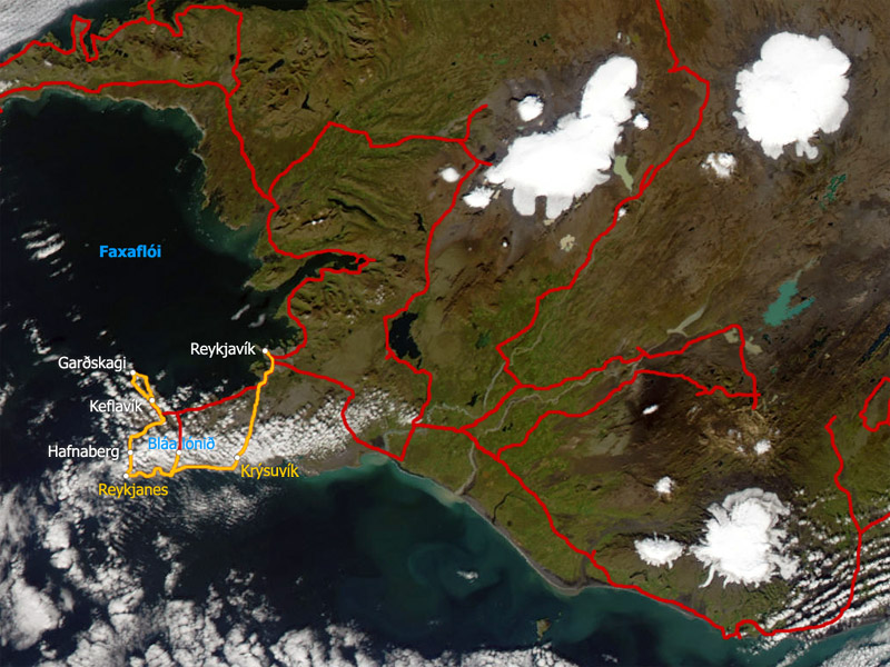
Keflavík - Reykjanes - Reykjavík Friday, July 2, 2004
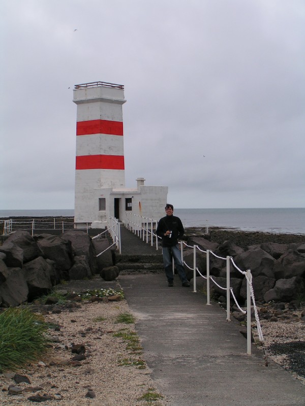
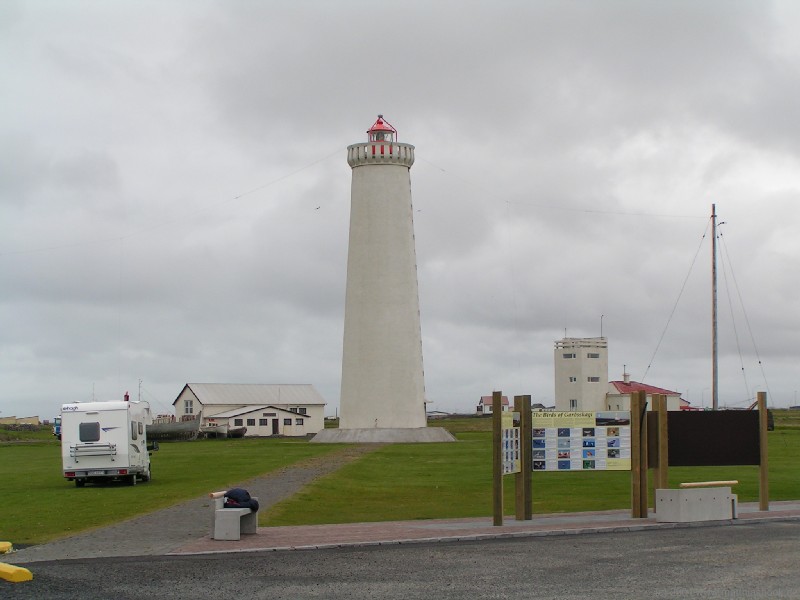
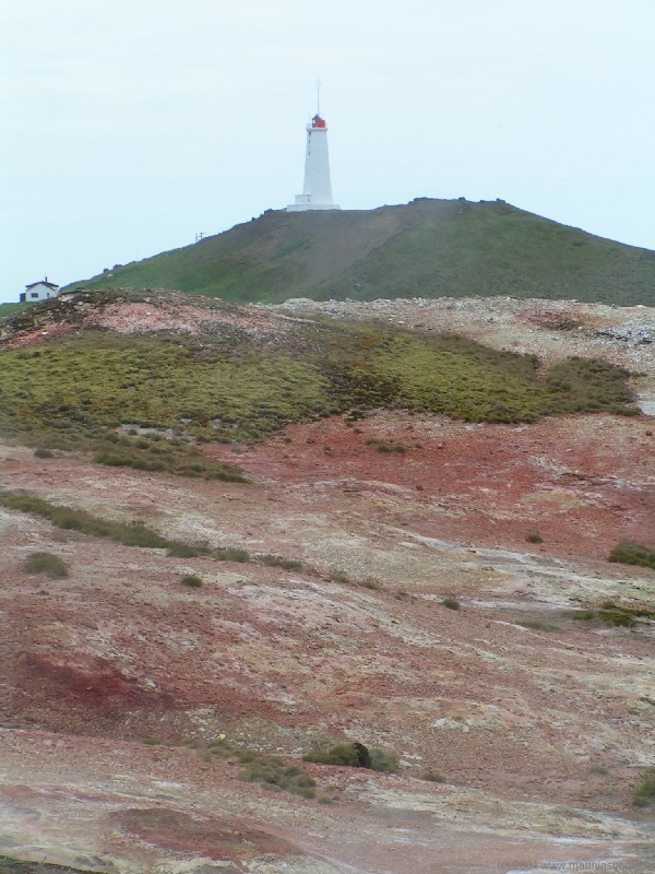
Even though there are already some other guests in the common kitchen, we're the first ones to check out. Feeling that it's time for breakfast, we ask the girl at the reception for directions to a grocery store, and she refers us to downtown. From six residents in 1703, Keflavík ("Driftwood Bay") has grown to almost 8.000 inhabitants today, making it one of the biggest towns and the second-largest export port of the country. However, as we're driving through the quiet streets, we find all stores and cafés still closed at this time. Unable to get breakfast for now, we head out on road 45 to Garðskagi, the northernmost tip of the Miðnes peninsula. On clear days, it's possible to look across the Faxaflói bay all the way to the Snæfellsjökull from here - not today though, so the two only sights are the old lighthouse of 1897 and its successor built in 1944, the highest in the country.
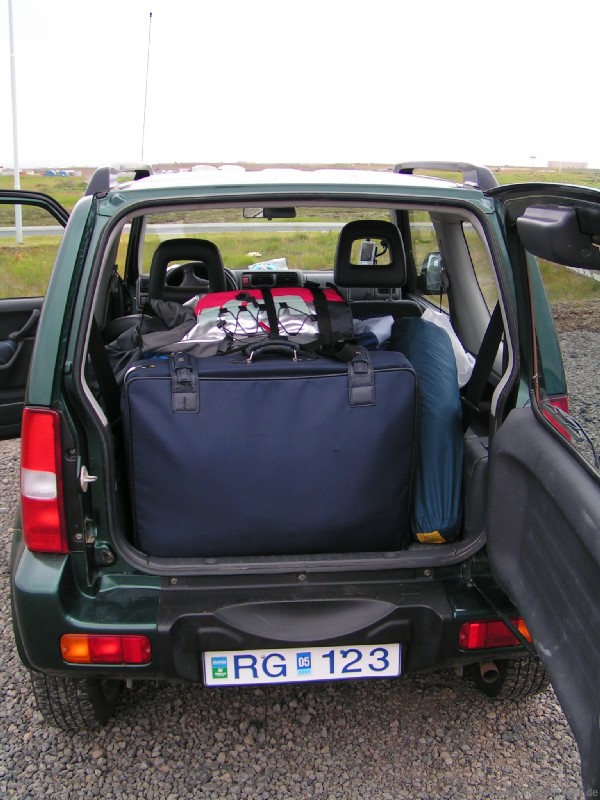
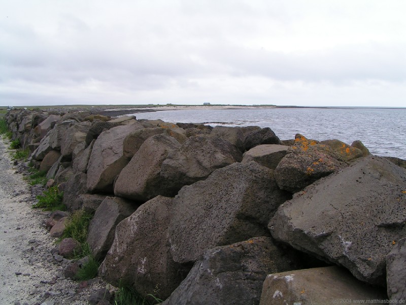
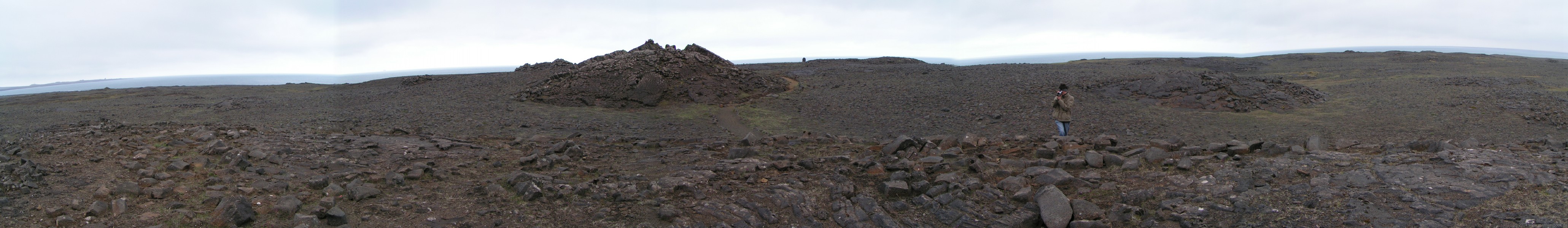
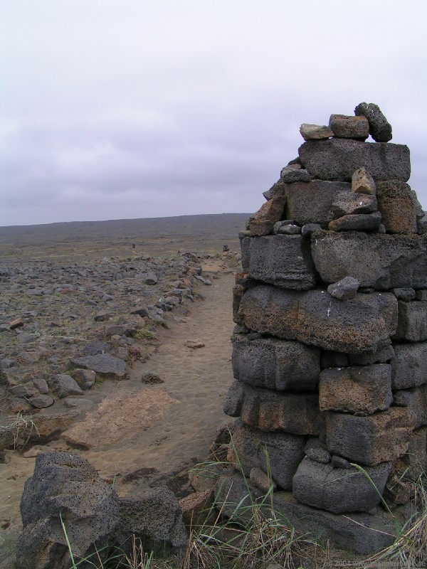
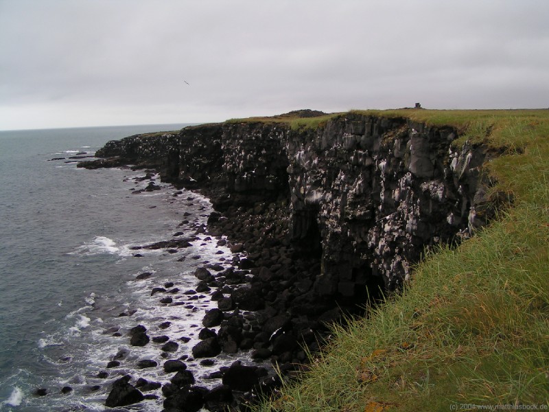
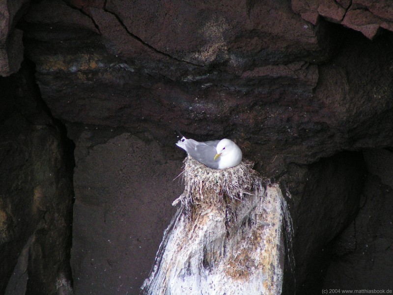
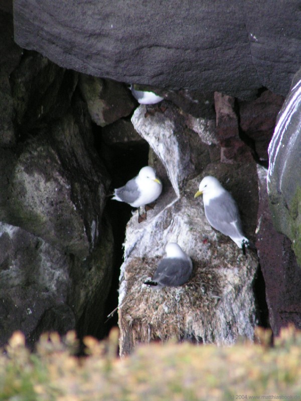
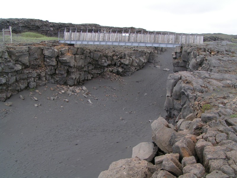
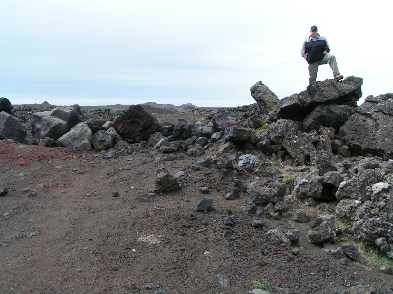
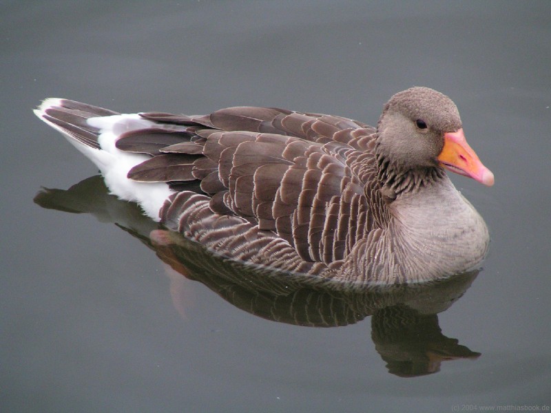
We continue to Sandgerði (pop. 1.400) and arrive in time for the opening of the town's supermarket, where we buy the typical camping groceries - cheese, noodles, chocolate bars, bottled water and soda. Surprisingly, we're unable to find any canned meat suitable for cooking. Our breakfast consists of a big pastry with sweet, sticky chocolate icing. On the way back on roads 429 and 44, we pass between Keflavík and its half civilian, half U.S. military airport again before we take road 425 south. Lava dominates the scenery on both sides of the road - about three quarters of the peninsula consist of more than 12.000-year-old lava, making it a geologically young formation. About halfway between Hafnir and Cape Reykjanes, we stop for a first hike to Hafnaberg, one of the largest seabird breeding sites in Iceland. Marked by tall cairns, the sandy path winds through the old lava for about 3 km. Only as we come closer to the sea does the scenery become a bit greener. When our car has shrunk to a mere dot in the distance, we reach the edge of the 30 m high cliffs. They are inhabited by countless kittiwakes, shags and fulmars that fill the air with their screeching. Walking back, we also see the first whimbrel with its characteristic long beak.
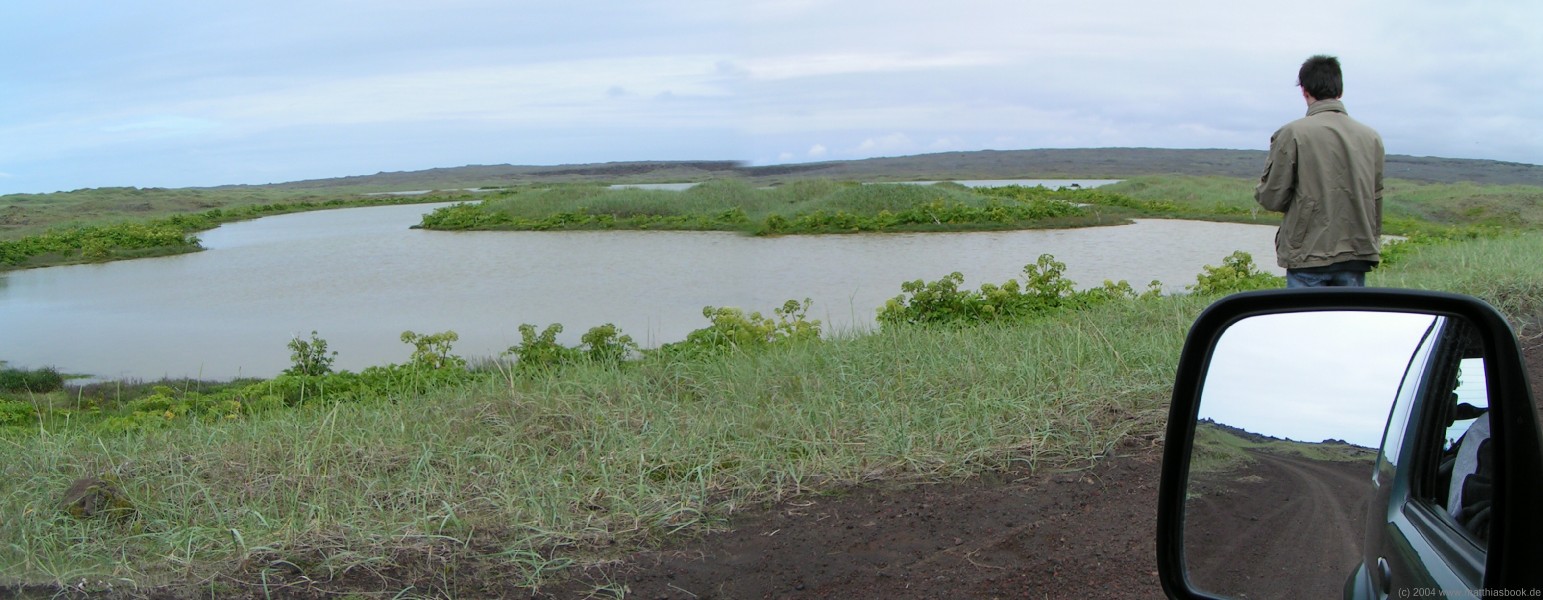
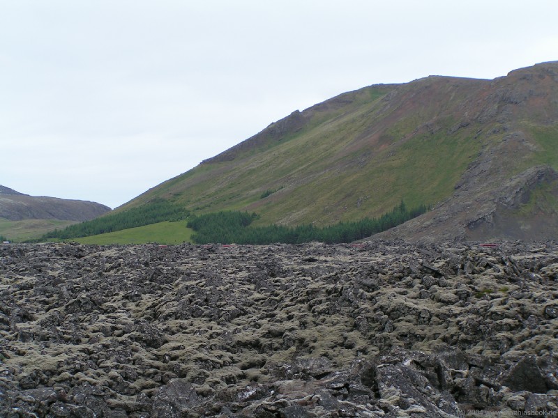
We've been driving on asphalt roads so far, but are eager to try out our Jimny's four-wheel drive. Off-road driving is strictly prohibited in Iceland to protect the fragile fauna, but there are plenty of side roads and jeep tracks of widely ranging quality (usually much worse than what continental European drivers would call a road, let alone subject their vehicles to). When the track to the Sandvíkur bay branches off the main road, we're excited for the opportunity to switch to 4x4 mode. The dirt road leads down to the wide Stóra-Sandvík bay with black beach and dunes. Before we know it, the track fades away and we drive along the beach. Any non-4x4 vehicle would get hopelessly stuck at this point, but with reduction gear engaged, our Jimny crawls steadily onward with a funny "swimming" feeling. Old skidmarks lead between the dunes, but we resist the temptation to scale the sandy hills - no reason to challenge St. Christopher this early on our trip! Instead, we turn around and follow the jeep track that leads all the way south through a 2.000-year-old lava desert to Cape Reykjanes, according to our map. The stony track winds between blocks of lava and black dunes, passing by a lake with rich bird life. After a while, our way is blocked by a row of big boulders lying on the track - the Icelandic version of a road closure, and one of the many surprises drivers must always expect on jeep tracks. Roads may be closed when they're not (even by Icelandic standards) safe anymore, or to protect wildlife breeding in the area, so we respect the closure and turn around.
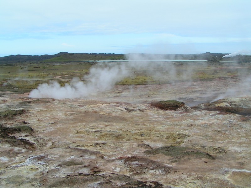
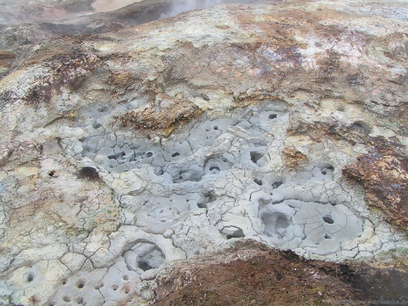
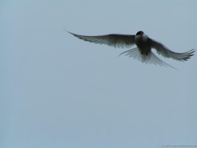
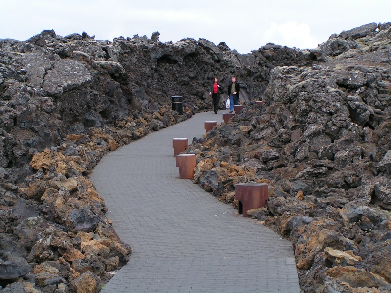
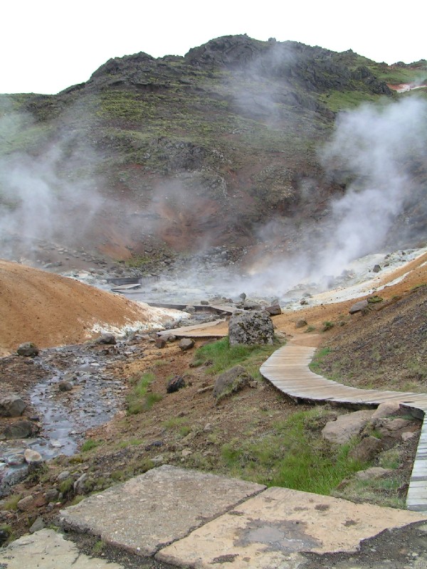
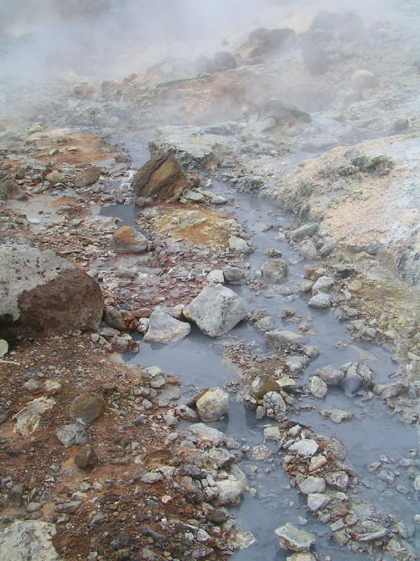
Back on road 425, we finally reach Cape Reykjanes on the southern tip of the peninsula. Arctic terns besiege the road to the lighthouse and are only mildly impressed by passing cars. The salty smell of the sea mixes with the sulfuric odor of the Reykjanes geothermal area after which the whole "smoking peninsula" is named. A wooden walkway leads right in between bubbling solfatara and hissing fumaroles. Clouds of steam envelop us - we don't even try to evade their odor but figure we might as well get used to it since it'll accompany us for the better part of the coming two weeks. When a busload of American tourists arrives, we flee down to the shore that is dominated by the Valahnúkur cliff. A nearby picnic table invites us to lunch - bread with cold cuts and soda.
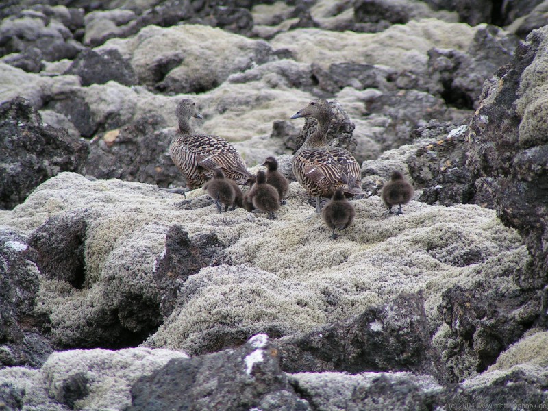
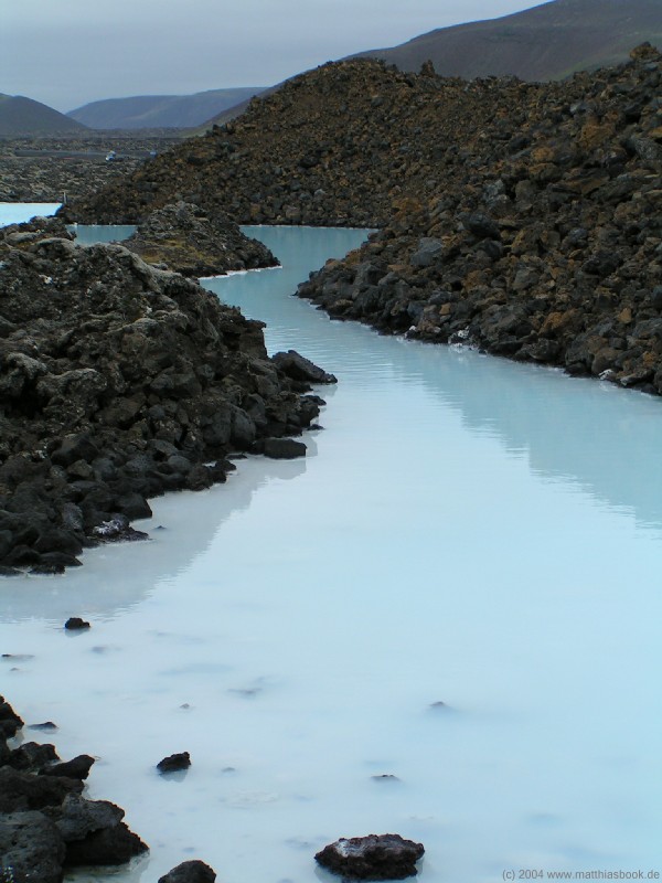
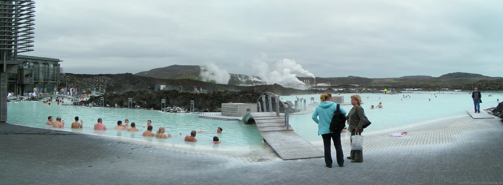
We continue east on road 425 that now turns into a dirt road - a usual phenomenon for Icelandic roads that don't serve major population areas. At Grindavík, we turn north on road 426 that leads through the 700-year-old Arnarseturshraun lava field covered in thick moss and inhabited by common eider ducks. Our destination is Bláa lónið, the "Blue Lagoon" - probably one of Earth's most bizarre swimming pools. 5 km north of Grindavík, the Svartsengi geothermal plant taps into a 200 °C high-temperature field, pumping 1.000 tonnes of boiling salty lye per hour up from a depth of 2 km. Once it has been used to heat freshwater and generate power in steam turbines, the mineral-rich geothermal water is released into a large retention basin. This milky-blue pool surrounded by black lava rocks has been a popular bathing place ever since the plant was built, but when it was discovered that the high-silica water has a healing effect for skin diseases such as psoriasis in the 80's, visitor numbers increased considerably. Today, over 300.000 people visit the 5.000 m2 Blue Lagoon geothermal spa each year. The new spa facilities built in 1999 are ultra-modern: At the entrance, we receive a RFID wristband that serves as a key for our lockers and virtual wallet for the spa's restaurant. As we walk outside after changing, it just feels chilly for a moment before we dive into the 38 °C warm water. Walking slowly through the lagoon that's no deeper than 1,5 m anywhere, we discover the facilities: At several hot spots, 42 °C hot water from the power plant is injected into the lagoon. Elsewhere, buckets of white silica mud are available for visitors to smear all over their skin for its healing effect - of course, we try some too. After letting the stuff dry, the best place to wash it off is underneath a salty waterfall. We also try a Finnish sauna and an Icelandic steam bath in a dim cave for a while. Reluctantly, we finally get ready to leave again since we still have some kilometers ahead of us.
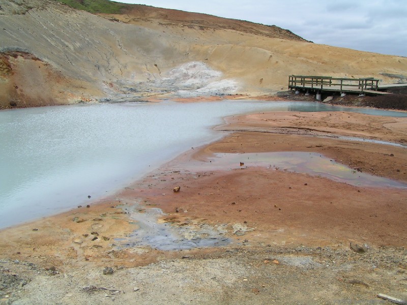
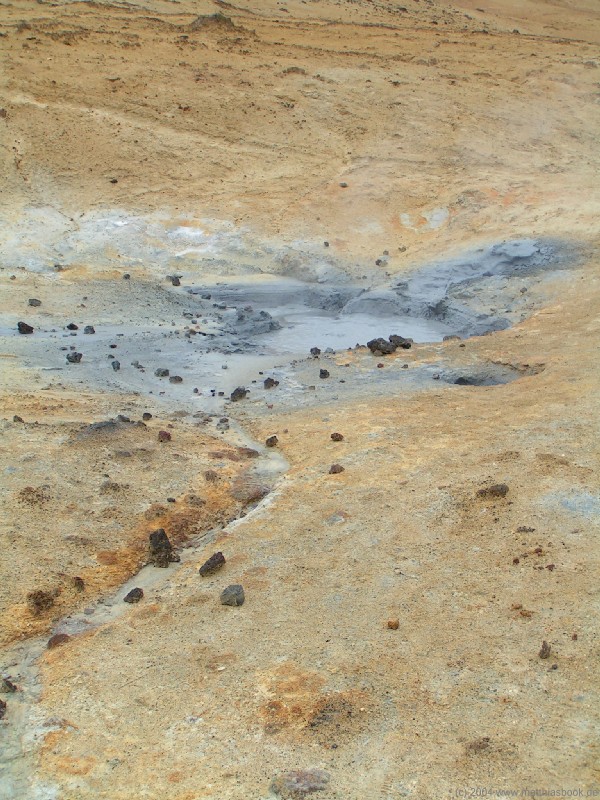
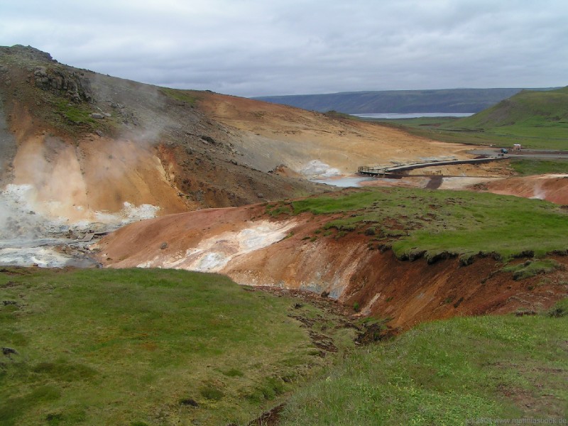
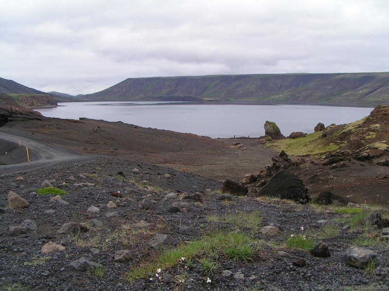
We return to Grindavík and turn east on road 427. The dirt road leads us around the 190 m high Festarfjall (or rather the remaining half of this pre-historic extinct volcano that withstood the sea's eroding forces until now) and through the moss-covered Ögmundarhraun lava field of 1151. We then turn north on road 42. Shortly after passing the turquoise-green lake Grænavatn, the dark green plant cover of the Sveifluháls ridge is broken up by brown, red, orange and yellow areas indicating a sulphuric soil. We've reached the Krýsuvík geothermal area, where sulphur was mined until the beginning of the 20th century. Billowing clouds of steam lead the way to numerous solfatara and fumaroles on the hillside. A boardwalk runs directly through the area, past bubbling mud pools and hissing vents and over dry crusts of multi-coloured mud. Krýsuvík was a busier area in the recent past, however, after an earthquake in 2000, its geothermal activity has quieted down a bit. The same earthquake also had a spectacular effect on the Kleifarvatn lake farther north: Since underground rifts widenend in 2000, the lake is leaking: Within two years of the quake, its original area of 10 km2 shrunk by 20%, and its water level dropped by 4 m. It is unknown whether the whole 97 m deep lake will be completely drained, or if the water level will eventually remain stable or even rise again.
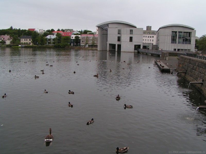
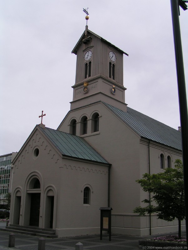
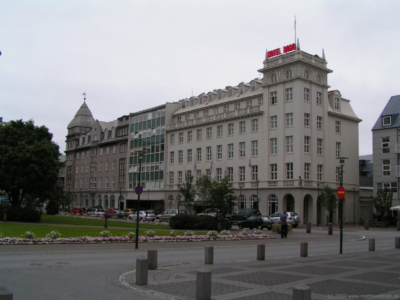
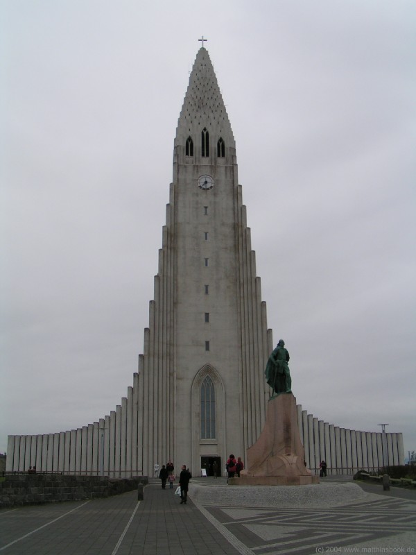
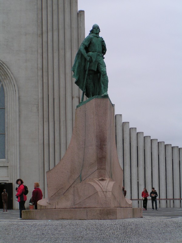
Continuing north on road 42, we reach Hafnarfjörður, a suburb of Reykjavík. We turn east on Reykjanesbraut and enjoy some of the very few kilometres of four-lane highway that can be found in Iceland as we drive through the suburbs Garðabær and Kópavogur into Reykjavík. We continue along the shore on Sæbraut and finally take Lækjargata right into the city center. We find a parking spot close to the city pond Tjörnin and go for a walk through the center that's part sightseeing, part food-hunt. Tjörnin is a habitat for over 50 bird species, mostly swans and ducks. On its northwest corner sits the Raðhus, the new city hall of 1992. One block north, we find the Dómkirkjan cathedral that was consecrated in 1796. Back then, it had space for almost all inhabitants of Reykjavík - today, the capital's population is 115.000. After such a long day, our craving for food soon surpasses that for sightseeing, so we walk up the main shopping street Laugavegur in search for a place to eat. Deterred by the high prices, we're not immediately successful, but walk up all the way up to Hallgrímskirkja, the largest church of Iceland with a unique architecture depicting basalt columns. In front of the church, a statue commemorates Leifur Eiríksson: A Greenlandic settler of Icelandic descent, he was the first westerner to set foot on the North American continent around the turn of the first millenium.
After checking out many restaurants, we finally have dinner at the Caruso on the corner of Þingholtstræti and Bankastræti. We still have to get accustomed to Icelandic prices and thus settle for pizza (after all, they supposedly serve Reykjavík's best at this place, according to our guide book). After dinner, we finally call it a day and drive over to the Laugardalur campground - right next to Laugardalslaug, one of Reykjavík's seven outdoor swimming pools in the city center, but still remarkably quiet at night. < 01/07/2004 | 03/07/2004 > |
||||||||||||||||||||||||||||||||||||||||||||
|
|