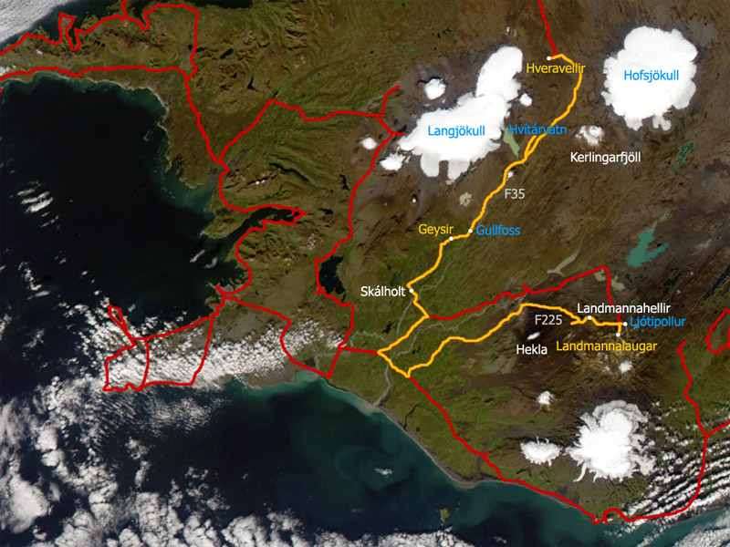
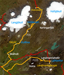
Landmannalaugar - Geysir - Gullfoss - Hveravellir
Sunday, July 4, 2004
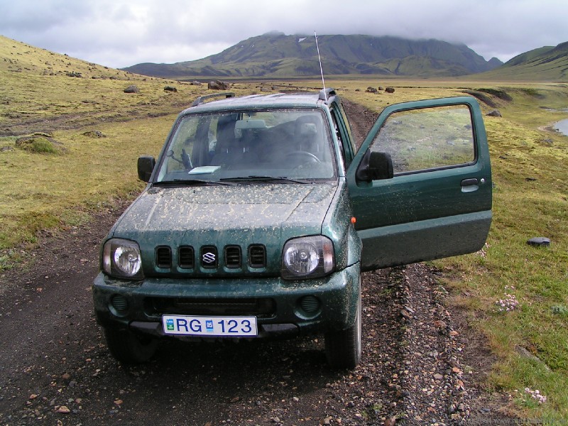
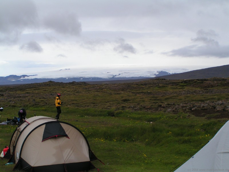
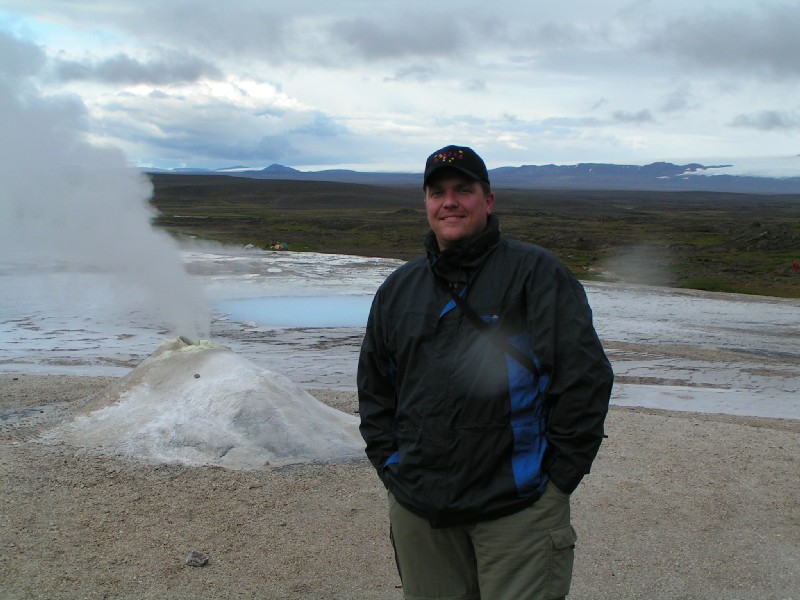
 Our first peek out of the tent this morning does not meet a promising sight: The clouds are hanging low as ever - if anything, even thicker clouds seem to glide in through the valley, and soon, rain begins to drizzle again. We have breakfast under the roof of the modern wood-and-steel picnic area, watching a couple of imperturbed trekkers in raingear embarking on the Laugarvegur, a four to five day hike south to Þórsmörk. However, even though there are a quite a few interesting shorter trails to solfatara, fumaroles and the obsidianic Laugarhraun lava stream in our area, we're not in the mood for hiking - we finally want to get out of the clouds and into better weather. We ask the hut warden for the weather forecast and the ford conditions along our planned route (the former being less encouraging than the latter), then get on our way. The ford at the entrance is familiar now; we pass through it on the proven way without problems.
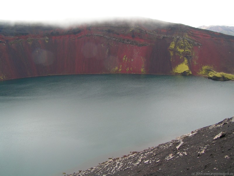
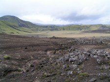
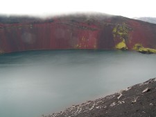 Ljótipollur
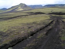
At the crossroads of F208 and F225, we first turn east for a short excursion to Ljótipollur. What looks like a volcanic crater at first sight is actually a maar - the remains of a huge explosion that occured when groundwater came into contact with hot magma and evaporated instantly, leaving a deep hole surrounded by ejected soil. The steep, fluffy slopes of Ljótipollur are glowing in dark red even under this overcast sky, contrasting with the dark green-blue water.
 Landmannaleið (F225)
After rolling down the steep, stony road from the rim in lowest gear, we continue east on Landmannaleið (F225). This alternative access route to Landmannalaugar is more challenging than the northern route that we came in on, since it includes a number of fords. We get ahead well though - the gravel road is relatively free of potholes, and the cloud cover breaks up here and there, illuminating mountain ranges that are either pitch black or saturated green - a stark contrast. At the little lake Dómadalsvatn, we spot a huge white swan that is so big that it could probably have stuck its head through our window if we had gotten close enough.
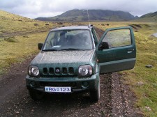
 The road then forks into a northern and a southern route around the Kringla range. Since the fords of the Klukkugilskvísl on the southern route may be difficult after all the rain of the past days, we take the northern route that's supposed to have more benign fords. When we approach the first ford, though, a guy standing next to a black compact car flags us down. Having seen yesterday how Icelanders breeze through fords even in compact cars, we can just imagine what's troubling him. "I've been driving around all day yesterday without any problems at the fords, but this one just killed my engine this morning", he explains. We open the hood of the Jimny and try to jump-start his car a couple of times, but it's no use - the engine doesn't even turn over. The driver stays calm: "Could you give me a ride to Landmannahellir?" The hut and campground there are just a few kilometers away, so Nils agrees to shuttle him over. Meanwhile, Matthias waits in the grounded car, which at least offers some protection from the wind. When Nils returns about 20 minutes later, we leave the black car behind and get on our way again. We're still shaking our heads at people's attitude to their cars here, but are confident the wardens at Landmannahellir will be able to assist the guy.
 Past Landmannahellir, we drive along a river that's split into many arms separated by sandbanks. According to the map, we'll have to ford it sooner or later, and just hope it'll be in a sufficiently safe spot.
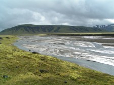 Indeed, the road soon leads down into the riverbed. The first arms we cross are mere trickles across the gravel, the next one is wider, but looks pretty calm and flat too; Nils slows down a bit and then drives right in; we roll steady for a second, then the Jimny's nose suddenly dips deep down into an underwater trough for a split second before we crawl up the opposite bank. Whew - that could have been a close one! Better not think about what would have happened if that trough had been deeper or steeper, and better not underestimate any future fords, even if they look harmless at first sight!
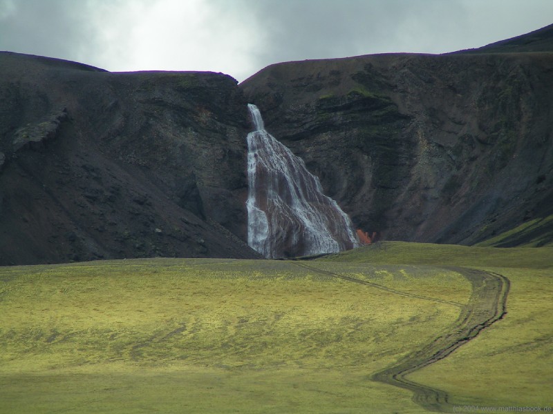
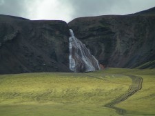 Right after the ford, our road merges with the southern route around the Kringla range again. In the south, we see the wide sheet of the Rauðufossar waterfall. Eager to get a closer look, we try to find a way leading up there. A number of tire tracks look obvious but decidedly illegal, so we just take the next jeep track south.
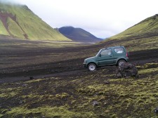
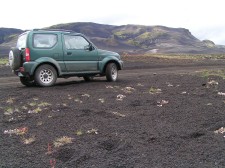
 We soon realize it's turning too far west, bypassing the Rauðufossar and actually leading up to the Krakatindur range, but we just keep going for the fun of it. The track soon becomes very rough, and long trenches are running ominously close by the tire tracks. Offsetting the Jimny halfway off the track, Nils manages to avoid them, zooms down the steep ditch of a small rivulet and back up on the other side, dodges rocks on the ground... it is a fun and exciting ride, but we reluctantly realize it's not getting us anywhere, so we turn around and pick our way back down among the rocks and trenches.
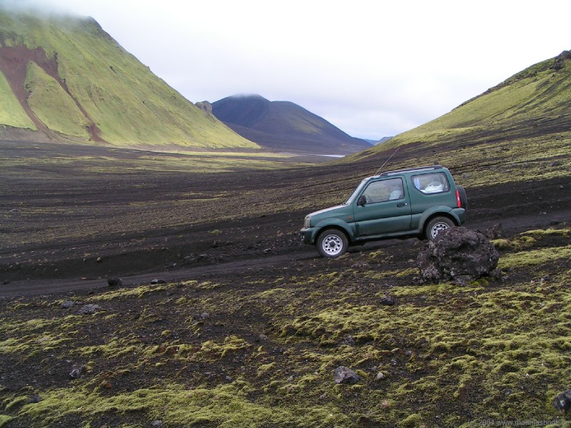
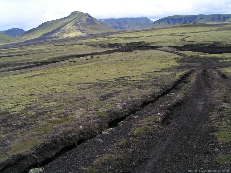
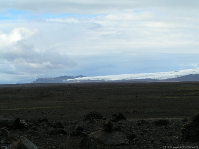
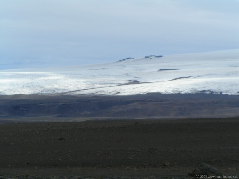
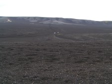 We continue along Landmannaleið which now leads through the pitch black lava deserts Skjólkvíahraun and Sölvahraun that have flown from Mount Hekla.
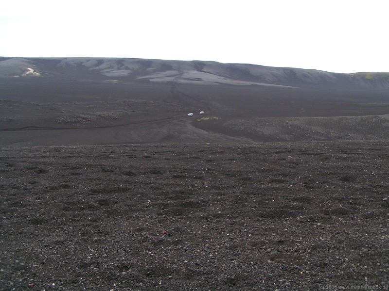
 The whole area seems devoid of life - when two white cars appear in the distance, they seem like moon rovers exploring a lunar landscape. It's no wonder that in medieval times, people considered Mt. Hekla the entrance to Hell. The volcano was dreaded back then as today for its frequent, violent eruptions that buried lands, destroyed farms and killed livestock. Some families have rebuilt their farms up to 20 times over the course of generations, knowing that it would only be a matter of time until the next eruption would destroy their work and force them to start over again. The most recent eruptions occured in 1980, 1981, 1991 and 2000. Right now, the Hekla is silent again, but nobody knows for how long.
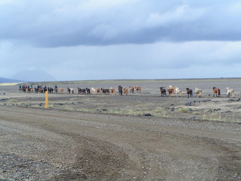
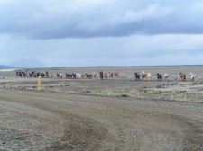 As we turn from Landmannaleið onto road 26, we see signs of life again: A trek of ponies is trotting by - many more ponies than riders actually, a typical Icelandic sight. We drive south in the same direction, discussing which way to continue our trip: West or east, clockwise or counter-clockwise? When we reach the main ring road and see that clouds are still hanging low in the south-east, we make up our minds and turn north-west. We stay on the ring road only for about 10 km, then we turn north-east onto road 30. At a parking lot close to the junction, the asphalt is twisted and torn - a result of the strong earthquake in 2000 that reached a magnitude of 6.6 on the Richter scale, destroying dozens of houses and damaging hundreds. The south-western region of Iceland is particularly prone to strong quakes since it lies between two rift zones, but has a pretty intact crust, so it takes considerable tension to tear it apart (which happens about once a century).
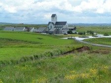
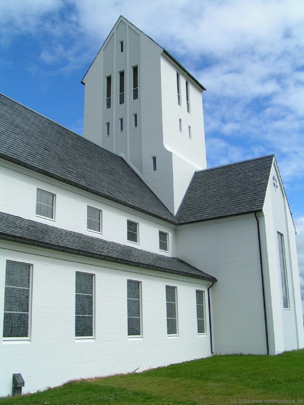
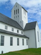 Skálholt
Continuing on road 30 before turning onto the 31, we're soon convinced that travelling clockwise was the right decision - the clouds break up, the sun is coming through, and when we reach Skálholt a good hour later, the weather's bright and warm. Skálholt became Iceland's first and most powerful diocesan town and cultural centre in 1056, when Ísleifur Gissurarson was elected as the country's first bishop. One of the biggest stave churches of all time was constructed here, but it was struck by lightning in 1309 and burned down. In 1784, the bishop's see was relocated to Reykjavík; today, Skálholt is a regular parish, but rich in history that is currently being unearthed in archaeological excavations all around the church.
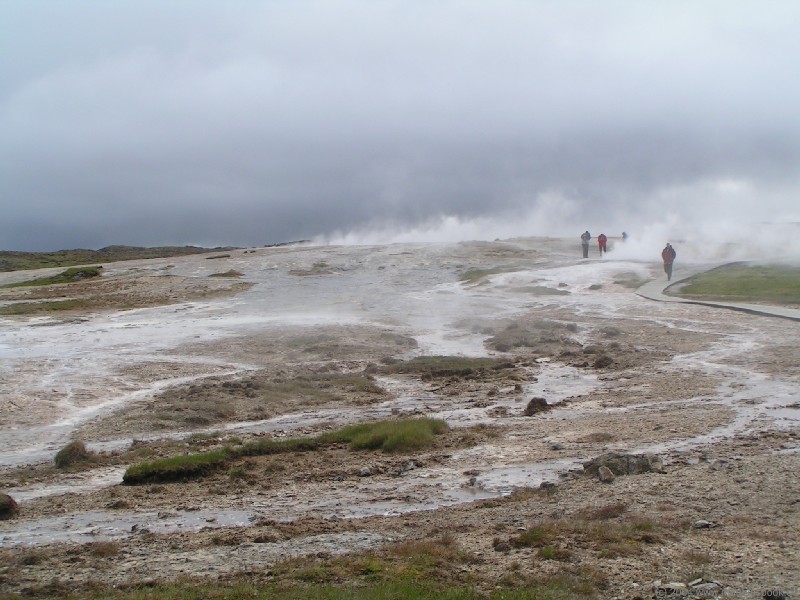
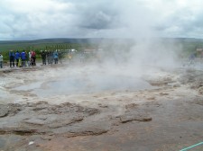
 Geysir
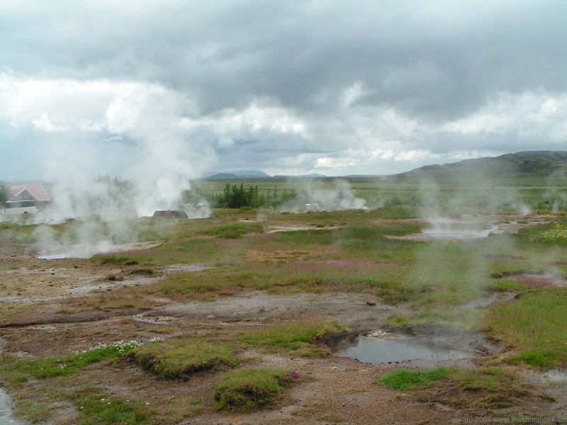
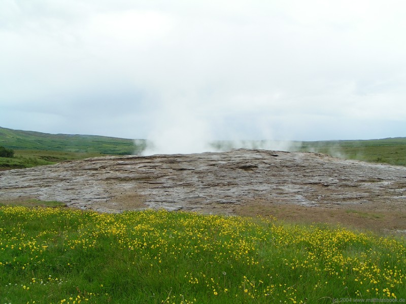
We continue our trip north on road 35. After a few kilometers, we can see white clouds of steam against the backdrop of green hillsides from afar - we're getting closer to Haukadalur and the Biskupstungur geothermal area that is only known by the name of its most prominent feature: After an earthquake in 1630, one of the hot springs in this area began to spout water up to 60 m high into the air.
 After the Icelandic word for "to well up", it was called Geysir - a name that has now become the general term for all hot springs of this kind. In a nutshell, a geyser is a water-filled chimney that reaches into the ground of a high-temperature area. Deep inside the chimney, the water is heated to over 100 �C but cannot boil because of the pressure of the water column on top. However, when the temperature rises sufficiently high, gases that had been dissolved in the water start to bubble up, reducing the pressure. The superheated water can now boil and evaporates explosively, ejecting the chimney's contents high into the air. As the water pours back down into the chimney and is heated up again, the cycle repeats.
 The eruptions of the original Stóra-Geysir ("Great Geyser") became more erratic and subdued over time, as earthquakes shifted its underground conduits. Questionable attempts to revive it by digging drainage trenches or feeding it with soap in order to reduce the water pressure were only temporarily successful and finally suspended because of environmental concerns. Today, the Stóra-Geysir is a quiet, steaming pool bordered by a mound of sinter terraces formed by layers upon layers of deposited minerals.
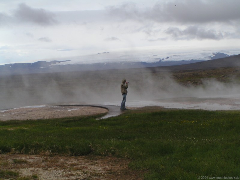
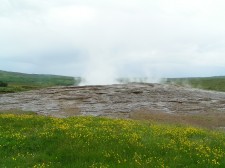
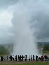
 Despite the Stóra-Geysir's inactivity, the geothermal area is one of Iceland's premier tourist destinations because of Strokkur ("Butter Churn"), its smaller, but more reliable neighbour: Every ten minutes, the water in its narrow chimney begins to surge up and down, sending waves of boiling water gushing over its rim. The surges gain intensity, then the water surface suddenly bulges up in a half-meter high, crystal blue dome that seems suspended in zero-gravity for a split second before a white jet of steam shoots up inside, bursts through the dome and erupts 20-30 m high into the air, tearing the water in the chimney with it. The air is filled with the hissing and spattering noise of water being ejected and falling back to the ground for long seconds, then the steam is blown away and reveals the gaping mouth of the chimney already refilling for the next eruption.
 We walk around Strokkur for a few eruptions, trying to get a good shot of the dome and the fountain - not an easy task with a gray, cloudy sky that provides virtually no contrast for the steam. Twenty years ago, it was up to visitors' own survival instincts how close they wanted to get to the geyser, but today, Strokkur is widely cordoned off to prevent anyone from receiving a scalding shower, and to protect the fragile sinter deposits around the chimney from being trampled by hordes of tourists.
Tour buses are arriving every few minutes in the spacious parking lot, passengers spill out and surround the geyser for a few cycles, visit the souvenir shop and are shuttled away again to the next highlight in Icelands "golden circle" of attractions. Again, the german tourists are most unnerving, providing constant live commentary and geyser predictions for their companions, though none of them are blind as far as we can tell: "It's rising! -- Now it's falling again... -- Any minute now! Any second! -- There! Look, look! -- Oh no, not yet... but now! It's gonna go! -- Wait, no... it's teasing us, haha... -- Yeah, it always takes some---WHOA!!!"
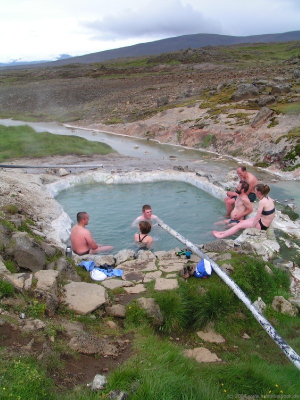
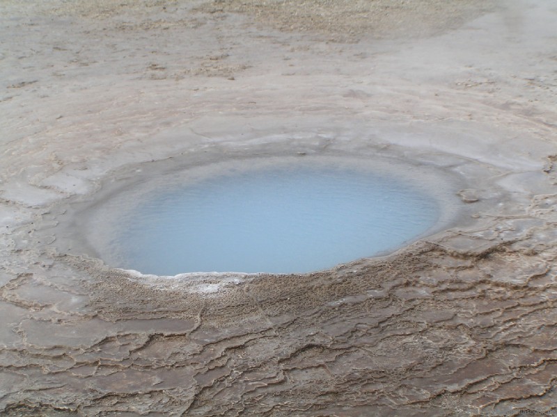
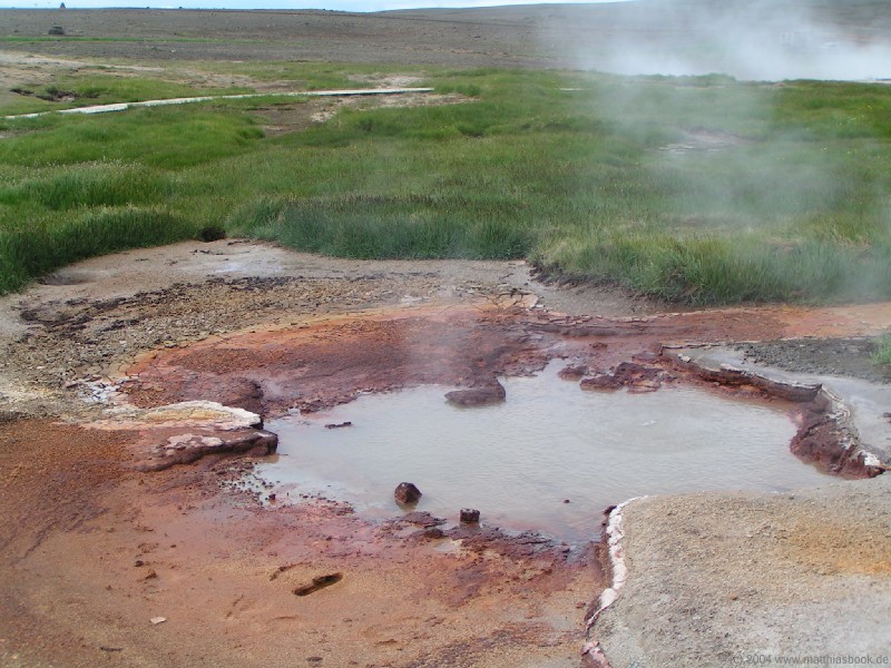
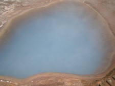 Soon, we can't stand the babbling anymore and wander off to the more silent, smaller hot springs - some busily bubbling, some hissing and seething, some silently steaming... Many are hiding in the grass and only give themselves away through the clouds, sounds and stenches emanating from them, while others are colouring their surroundings with the sulfuric yellow and red-brownish tones of deposited minerals and heat-loving organisms. The Blesi spring is a particular curiosity: The water in its twin basins is rich in silicic acid, which is dissolved in the clear boiling water of one basin, but falls out in the cooler water of the other basin, turning it a luminescent blue.
After walking around the geothermal area, we briefly check out the Geysir Center across the road - a tourist complex with hotel, restaurant, souvenir shop, and (perhaps most interestingly) a multimedia exhibition on Iceland's geology. The dark halls are filled with the fiery colours and rumbling sounds of volcanic eruptions shown on large video screens, while plates explain the physics behind Iceland's geologic history and features.
Gullfoss
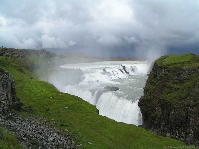
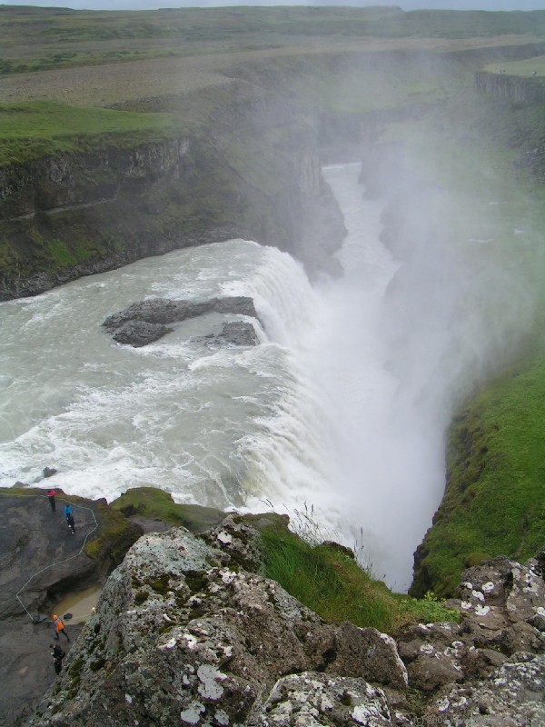
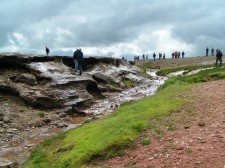
We continue north-east on road 35 for a dozen kilometers and reach Gullfoss, the "Golden Waterfall" - arguably Iceland's most beautiful, and certainly most popular. A boardwalk leads a few hundred meters towards a canyon shrouded in clouds of spray. Coming from the glacier Langjökull in the highlands, the silty waters of the Hvítá ("White River") first tumble over a broad diagonal step in the riverbed and then plunge down into a deep, narrow canyon. In the evening sun, the massive sheet of milky water glows in an orange light that gave the fall its name. Right now, however, the sky is cloudy again, and just a hint of a rainbow can be discerned hovering over the canyon.
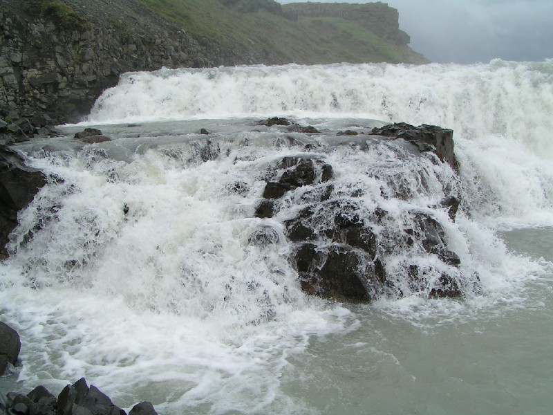
We walk closer to the falls on narrow, earthy paths cut through the green hillside. The closer we get, the more we're enveloped by the spray from the falls that's wafting everywhere. The path leads onto a natural rock platform jutting out between the upper and lower falls for a 270� panorama. From our left, the Hvítá streams broadly, then gushes, churns and foams over rocks as it tumbles 11 m down the rocks of the first step, and finally rushes 21 m down into the Hvítárgljúfur canyon. The air is filled with roaring thunder and dense spray as 110 m3 of water crash into the canyon every second.
To get a better view of Hvítárgljúfur, we climb up a steep path ascending to the top of the hillside. Compared to the tiny people scrambling over the wet black rocks, the huge Gullfoss looks like an untamable force of nature. In 1907, however, there were actually plans to build a hydropower station at this site - but Sigriður Tómasdóttir, the daughter of the farmer who owned the land and had already signed the lease, threatened to hurl herself down the waterfall if construction would indeed begin. The power station was never built, and in 1979, the Gullfoss area was declared a nature reserve.
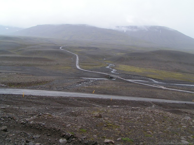
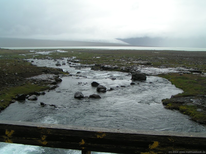
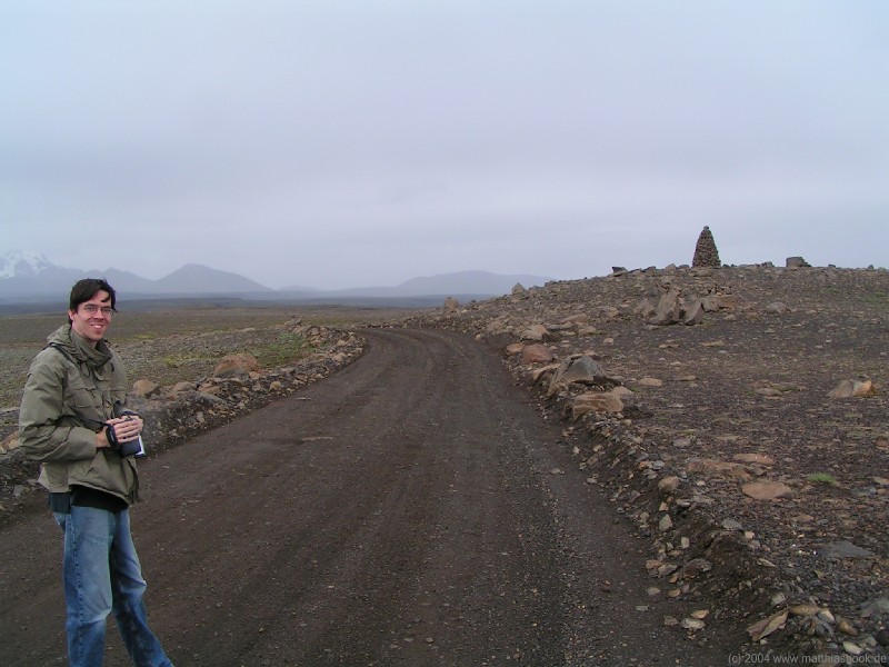
Kjalvegur (F35)
to be continued...
Hveravellir
< 03/07/2004 | 05/07/2004 >